Live airspace infrastructure
Airspace intelligence,
from the edge.
Build the network or put it to work. Connect a sensor to expand coverage and earn 4DSKY Points. Access trusted, real-time flight data.
Built on Edge-native by design
Trusted by









01The network
A stronger airspace picture starts with a better connection.
4DSKY connects professional-grade sensors directly to the applications that use their data. Neuron provides the trusted edge infrastructure, removing unnecessary intermediaries and single points of failure.
- System
Flight tracking sensors
Exposes live surveillance data
Edge-to-edge connection
- Client
Your application
Ingests data directly from sensors
'%20stroke-width='0.753918'/%3e%3cpath%20d='M30.7501%204.71421C30.3438%204.30818%2029.6119%204.15078%2028.499%204.36066C27.4005%204.56784%2026.0265%205.11803%2024.4635%205.98065C21.3419%207.70349%2017.5434%2010.629%2013.8189%2014.3534C10.0943%2018.0779%207.16839%2021.877%205.4455%2024.9986C4.5829%2026.5616%204.03268%2027.9357%203.8255%2029.0341C3.61564%2030.147%203.77303%2030.8789%204.17906%2031.2853C4.58534%2031.6915%205.31772%2031.8494%206.43089%2031.6395C7.52933%2031.4323%208.90338%2030.8821%2010.4664%2030.0195C13.588%2028.2966%2017.3871%2025.3707%2021.1116%2021.6461C24.8361%2017.9216%2027.7615%2014.1231%2029.4844%2011.0015C30.347%209.4385%2030.8972%208.0645%2031.1044%206.96604C31.3143%205.85283%2031.1564%205.1205%2030.7501%204.71421Z'%20stroke='url(%23paint1_linear_23_66681)'%20stroke-width='0.753918'/%3e%3cpath%20d='M79.4874%208.68183C83.3041%208.68183%2085.6896%2010.7161%2086.0411%2014.1311H83.4552C83.0534%2011.8712%2081.7472%2010.841%2079.3868%2010.841C77.1774%2010.8411%2075.8722%2011.7706%2075.8722%2013.3273C75.8722%2014.6078%2076.6251%2015.3861%2078.5333%2016.0139L81.8224%2017.0686C84.8857%2018.0478%2086.2921%2019.68%2086.2921%2022.216C86.2921%2025.43%2083.9824%2027.2628%2079.965%2027.2629C75.5959%2027.2629%2072.9091%2025.1037%2072.4572%2021.2619H75.0431C75.3695%2023.7728%2077.1021%2025.1037%2080.0148%2025.1037C82.4504%2025.1037%2083.7315%2024.1747%2083.7316%2022.4924C83.7316%2021.011%2082.9279%2020.2073%2081.1202%2019.6047L77.9806%2018.6008C74.7667%2017.5713%2073.3107%2016.064%2073.3107%2013.6535C73.3108%2010.6405%2075.7463%208.68191%2079.4874%208.68183ZM62.4376%208.9582C68.2631%208.9582%2072.0548%2012.4986%2072.0548%2017.9475C72.0548%2023.3963%2068.2132%2027.0373%2062.463%2027.0373H56.0851V12.0715L59.1984%208.9582H62.4376ZM109.99%2016.8674L115.063%208.9582H118L111.195%2019.1525V27.0373H108.533V19.1525L101.934%209.26679L92.9982%2017.6457L102.766%2027.0373H99.0245L90.2111%2018.2492V27.0373H87.549V11.4953L90.2111%209.01679V17.0939L98.6222%208.9582H104.943L109.99%2016.8674ZM52.9113%2020.9357H55.0704V23.1203H52.9113V24.2297L50.174%2026.967V23.1203H41.2599V21.0861L50.2745%208.9582H52.9113V20.9357ZM58.7472%2024.8273H62.4376C66.7564%2024.8273%2069.3427%2022.0154%2069.3429%2017.8977C69.3429%2013.855%2066.8067%2011.1682%2062.4376%2011.1682H58.7472V24.8273ZM44.4484%2020.9357H50.2745V13.0256L44.4484%2020.9357Z'%20fill='white'/%3e%3cdefs%3e%3clinearGradient%20id='paint0_linear_23_66681'%20x1='4.68353'%20y1='4.96169'%20x2='31.0171'%20y2='31.5521'%20gradientUnits='userSpaceOnUse'%3e%3cstop%20stop-color='white'/%3e%3cstop%20offset='0.332545'%20stop-color='white'%20stop-opacity='0'/%3e%3cstop%20offset='0.475962'%20stop-color='white'%20stop-opacity='0'/%3e%3cstop%20offset='0.635103'%20stop-color='white'%20stop-opacity='0'/%3e%3cstop%20offset='1'%20stop-color='white'/%3e%3c/linearGradient%3e%3clinearGradient%20id='paint1_linear_23_66681'%20x1='30.2464'%20y1='4.96169'%20x2='3.91291'%20y2='31.5521'%20gradientUnits='userSpaceOnUse'%3e%3cstop%20stop-color='white'/%3e%3cstop%20offset='0.328405'%20stop-color='white'%20stop-opacity='0'/%3e%3cstop%20offset='0.475962'%20stop-color='white'%20stop-opacity='0'/%3e%3cstop%20offset='0.633235'%20stop-color='white'%20stop-opacity='0'/%3e%3cstop%20offset='1'%20stop-color='white'/%3e%3c/linearGradient%3e%3c/defs%3e%3c/svg%3e) Edge-native
Edge-nativeDirect connections
Applications connect to data at its source, avoiding unnecessary infrastructure and latency.
Cloud server
Data routed through a central cloud server, adding latency and dependencies.
Resilient operation
A distributed network removes centralised bottlenecks and single points of failure.
Vulnerable to failure
Centralised infrastructure creates single points of failure and congestion.
Verifiable provenance
Neuron provides the trust layer between sensor owners and data users.
Trust the provider
Blind reliance on the provider's infrastructure, with no independent verification.
Open architecture
ADEX gives developers an open framework for direct, interoperable edge applications.
Proprietary lock-in
Closed protocols and vendor lock-in keep you tied to a single provider.
Sensor agnostic
Aggregates data from any compliant flight-tracking sensor, regardless of manufacturer.
Vertically integrated
Tied to a single sensor type with limited room to extend or mix hardware.
02How it works
For sensor contributors01
Own the coverage.
Track flights. Earn rewards.
Put a professional flight-tracking sensor to work. Contribute reliable, useful coverage and earn 4DSKY Points based on the quality of the service you provide.
- 01
Choose your location
Find a site with clear sky visibility and valuable network coverage.
Check my hex - 02
- 03
Improve and earn
Build Points through uptime, range, signal quality and coverage uniqueness.
Benefits and rewards
For aviation professionals02
Use the intelligence.
Operational data. Built to be trusted.
Integrate real-time surveillance data into safety-critical workflows, with edge-native resilience and a clear path to operational assurance.
- DAA
Drone operations
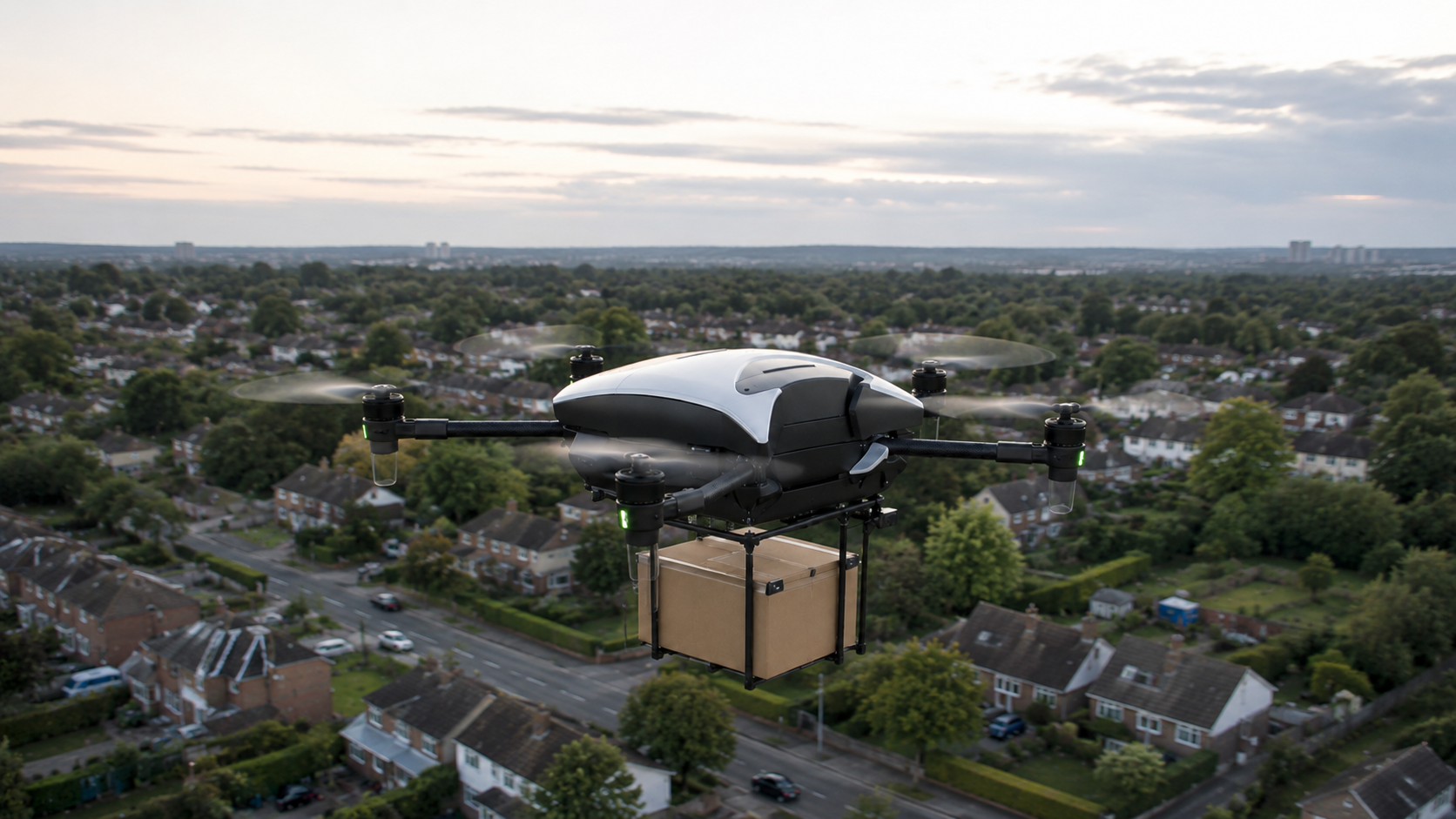
Low-latency surveillance data for detect-and-avoid, BVLOS operations and autonomy.
- FID
Airports
On-premise enhanced flight information services designed around operational assurance.
- UTM
Airspace management
Direct integration into UTM and ATM layers without an unnecessary cloud data hop.
- API
Data + analytics
Stream live flight data, evaluate coverage and run custom network queries.
03Data products
Choose how 4DSKY fits your operation.
Access 4DSKY through a cloud API, deploy a dedicated server within your operational environment, or use OpenFID as a ready-to-use flight information display.
LIVE + HISTORIC DATA
Cloud API
Access live and historic flight data through a cloud-hosted API. Integrate 4DSKY data into applications, analytics platforms and reporting tools without deploying local infrastructure.
- SENSORS
- 4DSKY Cloud
- Your Application
LIVE REAL-TIME DATA
Dedicated Server
Receive live surveillance data through a server dedicated to your operation. The server can be deployed on-premises and connected directly to airport, drone, UTM, ATM and detect-and-avoid systems.
- SENSORS
- Your Application
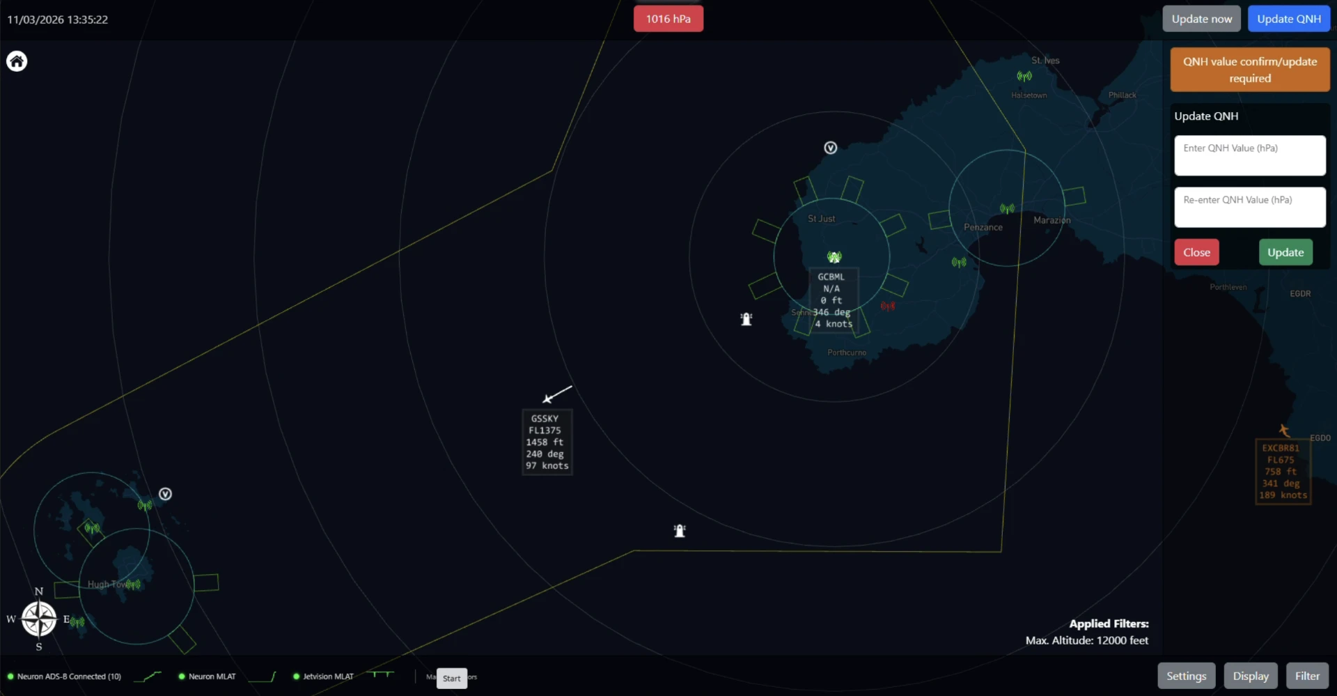
FLIGHT INFORMATION DISPLAY
OpenFID
Give airport teams a clear, ready-to-use view of local aircraft activity. OpenFID provides an operational flight information display powered by live 4DSKY data.
- SENSORS
- OpenFID
04Connect a sensor
Serious hardware. Simple onboarding.
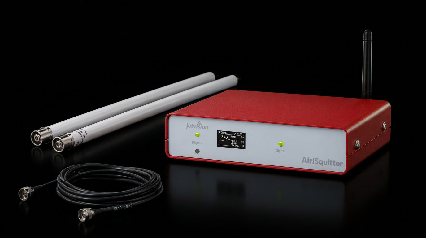
4DSKY supports Jetvision dual-antenna receivers with edge compute and precision GPS timing. They are built for dependable, multi-protocol surveillance in professional and community deployments.
Includes Neuron licence
- Frequencies
- 1090 MHz + 868 / 915 MHz
- Tracking
- ADS-B, UAT, Mode S, FLARM + MLAT
- Synchronisation
- 30 ns GPS time precision
- Connectivity
- Wi-Fi + Ethernet
05Network coverage
Check your hex.
Every sensor claims a hex of airspace. Search your location to see where the network is already live, which hexes are reserved, and where new coverage is needed most.
06Newsroom
All news →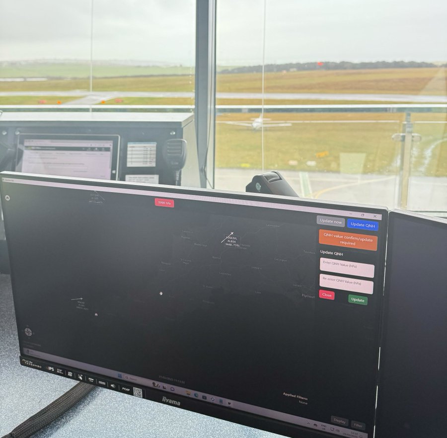
4DSKY deploys OpenFID at Lands End Airport
Deployment of 4DSKY OpenFID and Jetvision MLAT sensors to support lifeline logistics to the Isles of Scilly.
Read more
Neuron selected out of 3600 participants for NATO DIANA
Selection into the NATO Defence Innovation Accelerator (DIANA) 2026 Programme to advance resilient, secure edge communication and autonomous coordination in contested environments.
Read more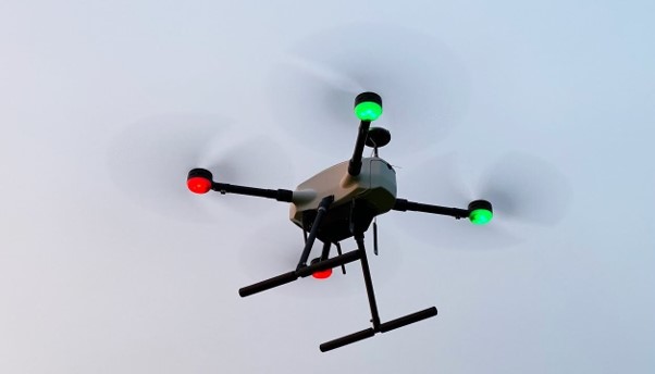
Neuron and 4DSKY win £3.6M project to build a blueprint for future airspace integration
A £3.65m UK government-backed initiative led by Neuron to define the national standard for BVLOS drone operations and Uncrewed Traffic Management (UTM).
Read more07Questions
Before you connect.
A location with good sky visibility, power, an internet connection and a secure mounting point. Rooftops and lofts often work well, subject to safe installation.
Points reflect the quality of your contribution, including uptime, signal range, reliability and the uniqueness of your coverage. Current programme terms are shown in the 4DSKY app.
You can still contribute, but unique and reliable coverage creates more value. Check the network explorer before choosing a location and aim for at least 2 km spacing where practical.
4DSKY uses professional hardware and has been tested in airport, UTM and DAA projects. Each operational deployment still follows the assurance, safety and regulatory approval process appropriate to its use.
The network is live